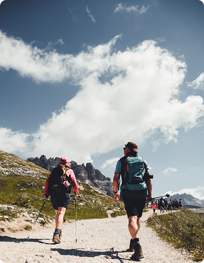
Trekking Around Pokhara Rim
Trekking Around Pokhara Rim is a short, scenic, rural-cultural trail that offers Panoramic Himalayan views, forest trails, lake views, and village...
View DetailsA Nepal-based trekking company that specializes in high-altitude trekking and immersive Himalayan journeys that connect travelers.

Rolwaling Valley Trekking is a remote and less-crowded adventure in eastern Nepal. You’ll be exploring an untouched valley with diverse terrains, from dense rhododendron forests to alpine pastures to imposing the pristine Tsho-Rolpa glacial lake and high mountain land.
The trek highlights are Yalung Base Camp (4,900M) and Tsho-Rolpa lake (4,500M) which is one of Nepal’s largest glacial lakes, with option to extend across the challenging Tashi Lapchha Pass (5,755M) into the Everest region. The valley is pure, raw, hidden and ideal for trekkers seeking solitude, authenticity and breathtaking Himalayan scenery.
Highlights of the day: The scenic road drive with views of terrace fields, rolling hills, rural village and continue downhill on rough road to Chet-Chet which is located near the Tama Koshi River. Start trekking by crossing the suspension bridge over Tama Koshi River, ascend steeply through forests, terrace fields, Sherpa and Tamang villages. Before arriving at Simigaun, the trail involves a continuous uphill ascend. It is a beautiful Sherpa and Tamang settlements with monasteries.
Highlights of the day: You’ll trek along the Rolwaling river, trail passes through lush rhododendron forests to more rugged mountain terrains deeper in the valleys. On the clear skies’ day, you can get the spectacular views of the Gauri Shankar Himal (7,134M). You’ll gain an altitude as you climb to Dongang and it is the small spot which is located in the bank of Rolwaling river.
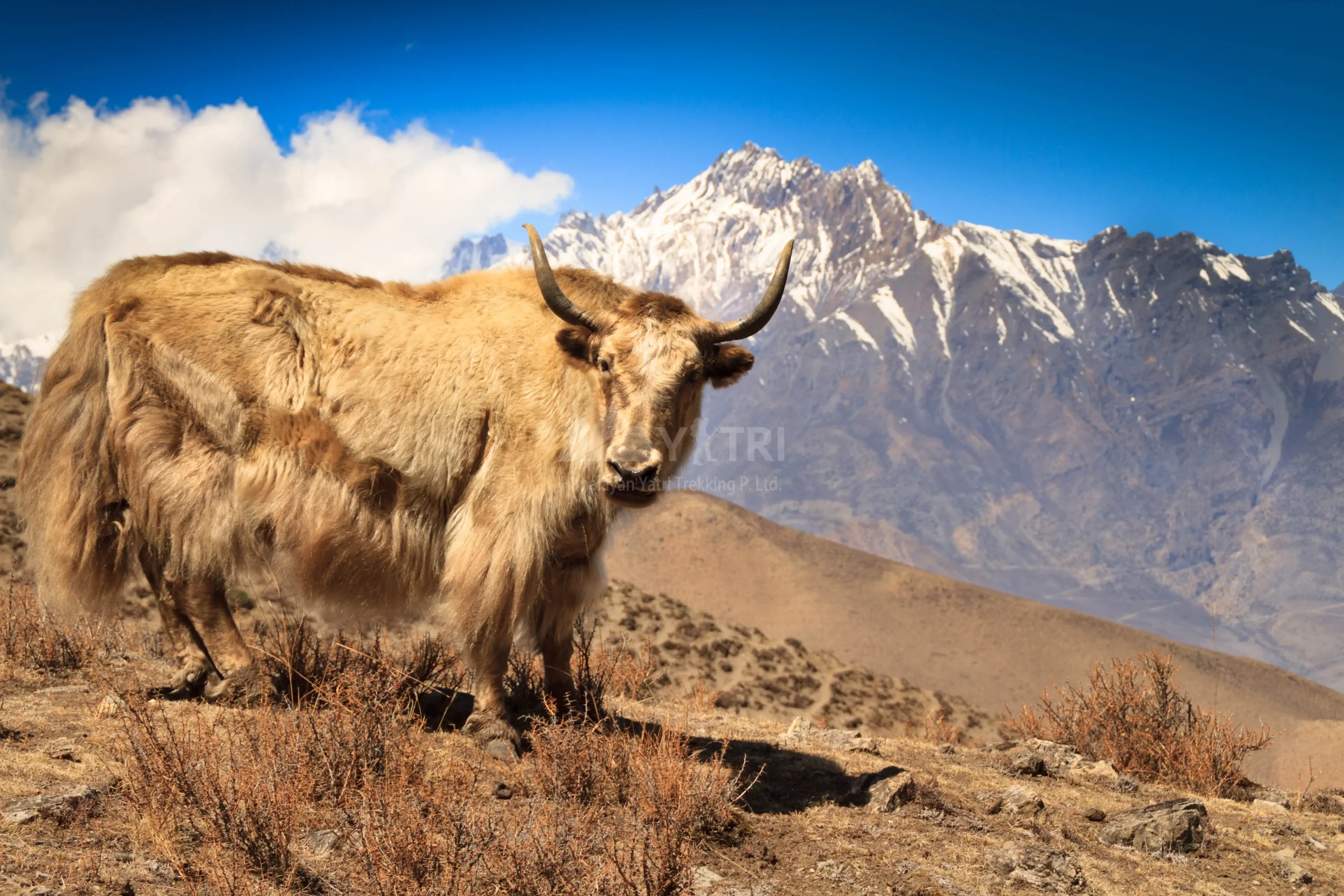
Highlights of the day: The route following along the serene river, often forested sections and crossing several small streams over wooden bridges. Beding is the largest and significant settlements in the Rolwaling valley. You’ll be visiting the ancient Beding monastery (Gomba), observing the local Sherpa culture and Yaks in their natural inhabitant.
Highlights of the day: Gradual but steady uphill climb along the river, following the lush to alpine forests, narrow with stone steps, rocky path to high alpine moraines. Arrive at Tsho-Rolpa Lake which is the glacial lake known for its stunning turquoise water reflecting the surrounding snow-capped peaks. Back to Na Gaun for overnight, it is the wide and small seasonal settlements with few Teahouse lodges.
Highlights of the day: You’ll leaves Na Gaun and heading steadily to Yalung Ri BC. The path is narrow, rocky and you’ll be crossing alpine meadows, moraine, glacial terrain to base camp. There are no teahouse lodges so you need to have your own pack-lunch and water. After spending some good times in base camp you’ll be heading back to Na Gaun for the overnight stay.
Highlights of the day: Enjoy the raw and unspoiled natural beauty of the Himalayas. Retrace the trail descending downhill to Dongang where you’ll encounter numerous prayer flags, prayer wheels, ancient monasteries which is reflecting the deep-rooted Buddhist cultures of the valley.
Highlights of the day: Retrace the mostly downhill trail following serene river, forests and farmlands. Simigaun is a mixed Sherpa and Tamang village which is culturally interesting do explore the village.
Highlights of the day: The route is descending through terraces fields, small villages, forests, crossing over suspension bridges. Trail is rocky, stone steps and it can be slippery if wet so you need to have your trekking poles and do walk carefully. Arrive in Chet-Chet, it is a small roadhead settlements where the road connects to the district headquarter Charikot and Kathmandu. You’ll be drive to your onward destination and transfer to your hotel.
TREKKING EQUIPMENT GUIDE FOR TREKKING IN THE HIMALAYAS
1) Head Wear
2) Hands Wear
3) Body Wear
4) Foot Wear
5) Sleeping
6) First-Aid Kit
7) Toiletries & Personal Hygiene
8) Backpack
9) Kit Bag
10) Important Documents
11) Others
The best time to begin the Rolwaling Valley Trek is during spring (March to May) and autumn (September to November). These seasons offer the most stable weather, clear mountain views, and comfortable trekking conditions.
In spring, the trail comes alive with blooming rhododendrons, green hills, and pleasant temperatures. It’s a great time if you enjoy nature and colorful landscapes.
Autumn, on the other hand, is the most popular trekking season. The skies are crystal clear after the monsoon, offering breathtaking views of peaks like Gauri Shankar. The trails are dry, making walking easier and safer.
Winter (December–February) is extremely cold with heavy snowfall, especially near Tsho Rolpa Lake, while the monsoon season (June–August) brings slippery trails and leeches, making trekking more challenging.
The Rolwaling Valley Trek is considered a remote and less-traveled adventure, which brings both beauty and difficulty.
One of the main challenges is isolation. Unlike popular routes like Everest Base Camp or Annapurna Circuit, this region has limited infrastructure and fewer trekkers.
Another major challenge is altitude. The trek reaches high elevations near Tsho Rolpa Lake (4,580m), where the risk of altitude sickness increases. Gradual acclimatization is essential.
The trails can be rugged and physically demanding, with steep ascents, rocky paths, and landslide-prone areas. Weather conditions can also change rapidly, especially in higher sections.
Preparing your body is key to enjoying this trek. While you don’t need to be an athlete, a good level of fitness and endurance is necessary.
Start training at least 4–6 weeks before your trek. Focus on:
Mental preparation is equally important. Since Rolwaling is remote, you should be comfortable with basic living conditions and long walking days (5–7 hours daily).
To reach the trailhead of the Rolwaling Valley Trek, you begin your journey from Kathmandu.
First, you take a long drive (6–8 hours) to Charikot in the Dolakha district. The road is scenic but can be bumpy in sections.
From Charikot, you continue by local jeep or private vehicle to Simigaon, which is the starting point of the trek.
Simigaon is a beautiful Sherpa village and serves as the gateway to the Rolwaling region. From here, the trekking adventure officially begins.
Accommodation in the Rolwaling Valley is basic but authentic. Unlike commercial trekking routes, you won’t find luxury lodges here.
Most trekkers stay in:
Facilities are limited, especially as you go higher. Expect:
In some remote sections, especially near Tsho Rolpa Lake, camping may be required if lodges are unavailable.
Despite the simplicity, the experience is incredibly rewarding. The warm hospitality of locals and the untouched beauty of the region make it truly special.
While solo trekking is possible, it is not recommended due to the remote trails, limited facilities, and potential safety risks. Trekking with a guide or group is a safer choice.
The trek is known for its untouched natural beauty, fewer crowds, traditional Sherpa culture, and stunning views of peaks like Gauri Shankar. It offers a truly off-the-beaten-path Himalayan experience.
It is not ideal for complete beginners due to its remoteness and physical demands. However, beginners with good fitness, preparation, and a guide can still complete the trek.
You start from Kathmandu, followed by a drive to Charikot, and then continue to Simigaon, which is the main trailhead of the trek.
The trek typically takes 10 to 14 days, depending on your itinerary, acclimatization days, and whether you extend the trek toward the Everest region.
Accommodation is mostly basic teahouses and homestays. Facilities are simple, with limited electricity and shared bathrooms. In higher areas, camping may sometimes be necessary.
You will need:
Gaurishankar Conservation Area Permit (GCAP)
TIMS (Trekkers’ Information Management System) Card
If your trek includes crossing into the Everest region via Tashi Lapcha Pass, additional permits may be required.
Yes, hiring a guide is highly recommended. Due to the remoteness, limited signage, and challenging terrain, a guide ensures safety, navigation, and a better overall trekking experience.
The highest point is Tsho Rolpa Lake, situated at an altitude of around 4,580 meters (15,026 feet). Some extended routes may cross the Tashi Lapcha Pass (5,755m), which is extremely challenging and requires technical skills.
The trek is considered moderately to challenging. It involves long trekking days, steep ascents, and high-altitude walking. The remote nature of the trail adds to the difficulty, making it more suitable for trekkers with prior experience.
The Rolwaling Valley Trek is located in the eastern part of Nepal, near the border with Tibet. It lies between the famous Langtang Region and Everest Region, offering a remote and less crowded trekking experience.
The trek reaches an altitude of around 3,660 meters (Khopra Ridge) and higher if you visit Khayer Lake. While the risk is moderate, proper acclimatization and hydration help prevent altitude sickness.
 09 Days
Trekking Around Pokhara Rim is a short, scenic, rural-cultural trail that offers Panoramic Himalayan views, forest trails, lake views, and village...
View Details 11 Days
Nar Phu Valley Trek is a remote, unique, and culturally rich Himalayan adventure journey in Nepal’s Annapurna region. The valley is...
View Details 07 Days
The lower Manaslu overland journey is a culturally rich, serene landscape, supporting communities, and experiences authentic local life. The trip leads...
View DetailsCustomize your own travel plans based on your needs and preferences.
Plan your trip