trip duration
Trip Duration 11 Days
trip duration
Trek Area Annapurna Region
trip duration
Suitable Season Spring (March to May) & Autumn (September to November)
trip duration
Difficulty Level Easy to Moderate
trip duration
Start/End Point Ghumaune Taal/Ghar Khola
trip duration
Trekking Hour 5-7 in a day
trip duration
Transportation Tourist Bus, Reserve Jeep and Porter on 1:2 ratio
trip duration
Highest Altitude Khopra Ridge – 3,660 m
trip duration
Group Size 2 to 10 pax.
trip duration
Accommodation Hotel in Cities (on request) & Tea-house lodge during the trek

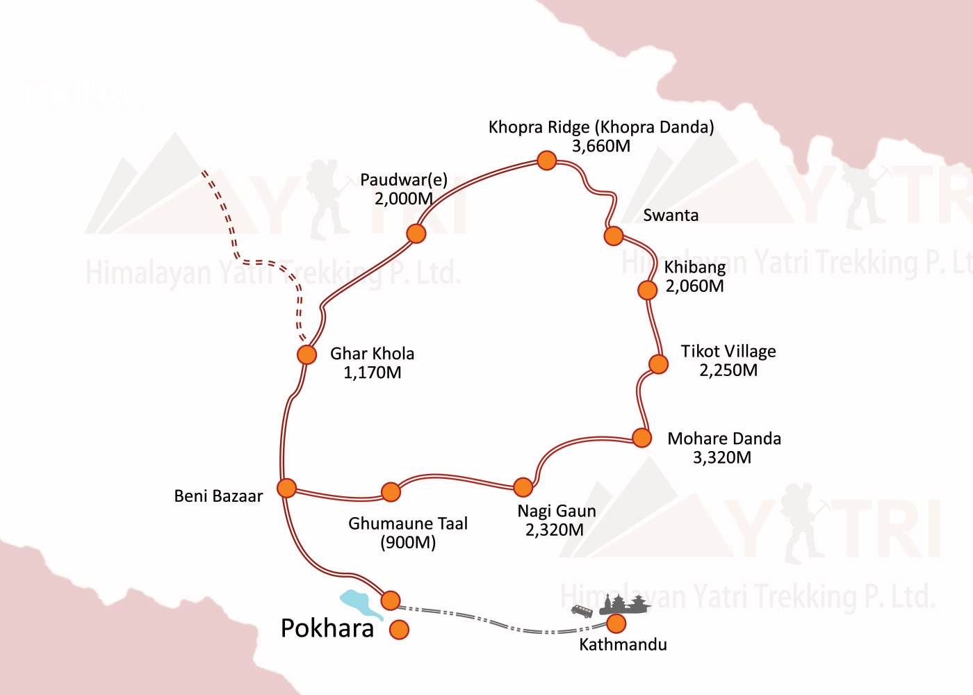
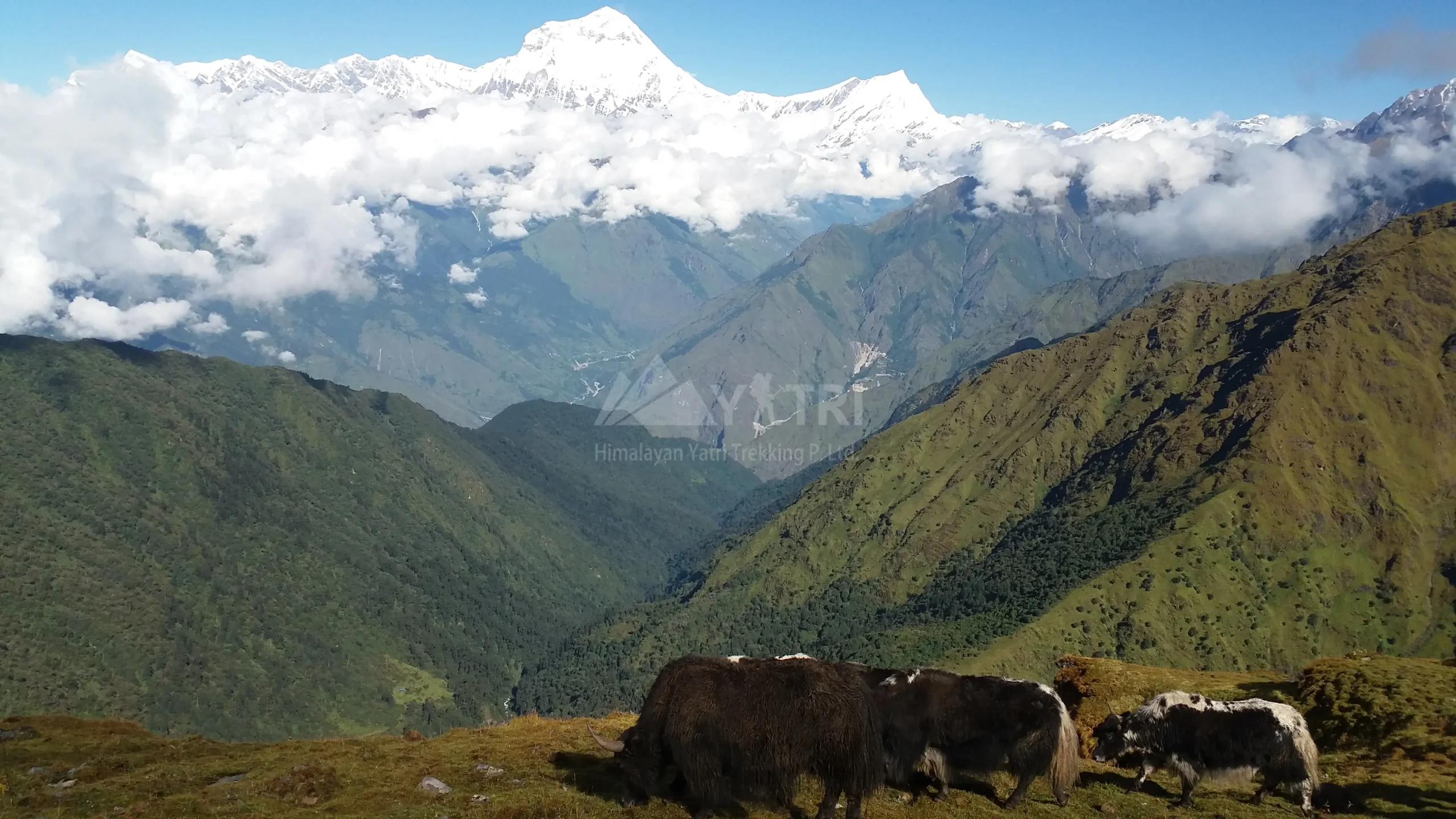
Quiet trail west of Pokhara, Khopra Ridge Community Trek links village homestays and community lodges across Magar settlements and forested ridges. After driving to Ghumaune Taal via Beni, we start up to Bans Kharka and Nagi Gaun, then gain the broad shoulder of Mohare Danda (3,320 m) for our first sunrise over Dhaulagiri, Nilgiri and Annapurna South.

Khopra Ridge Community Trek & Panoramic Himalayan Views

The route then weaves through Tikot, Khibang and Swanta—terraces, rhododendron, and monastery courtyards—before a steady climb to Khopra Ridge (3,660 m), an airy balcony with dramatic close-ups of Annapurna South and the Dhaulagiri range. Fit trekkers can add the long day hike to sacred Khayer Lake (~4,660 m).

We descend through Paudwar to the Kali Gandaki at Ghar Khola and drive back to Pokhara. Expect 4–7 hours of walking most days, warm hospitality, and your stay directly supporting local schools, clinics and conservation projects through community-run accommodation. Best seasons: spring and autumn trekking.

Why Choose Khopra Ridge Community Trek?

  • Less-crowded trekking trail in the Annapurna region
  • Panoramic sunrise views of Dhaulagiri, Annapurna South, and Nilgiri
  • Cultural immersion in Magar villages and homestays
  • Optional day hike to sacred Khayer Lake
  • Supports local schools, clinics, and conservation projects
  • Scenic forest and ridge trails with rhododendron blooms

Detailed Itinerary

Day 01

Drive Kathmandu → Pokhara – 822m

River-valley highway via Trishuli & Marsyangdi; sunset stroll along Phewa Lake.

Trip Facts
Max. Altitutde 822m
Trip Facts
Meal Plan Lunch, Dinner, Hot drinks
Trip Facts
Accomodation Hotel in Pokhara
Trip Facts
Activity 6–7 hrs drive (≈200 km)
Day 02

Drive Pokhara → Ghumaune Taal (900m) via Beni Bazaar, trek to Bans Kharka – 1,526m

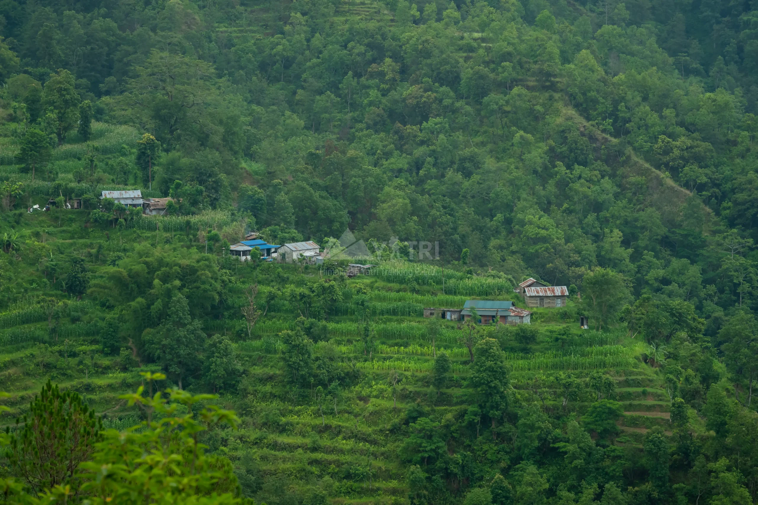
Scenic drive to the Kali Gandaki corridor; begin the Community Eco-Trail with a steady forest climb to Bans Kharka, a Magar village lodging in community-run homestays that support local schools.

Trip Facts
Max. Altitutde 1,526m
Trip Facts
Meal Plan Breakfast, Lunch, Dinner, Hot drinks
Trip Facts
Accomodation Community homestay/lodge
Trip Facts
Activity 3.5–4.5 hrs drive + 3–4 hrs trek (stone steps/forest)
Day 03

Trek Bans Kharka → Nagi Gaun – 2,320m

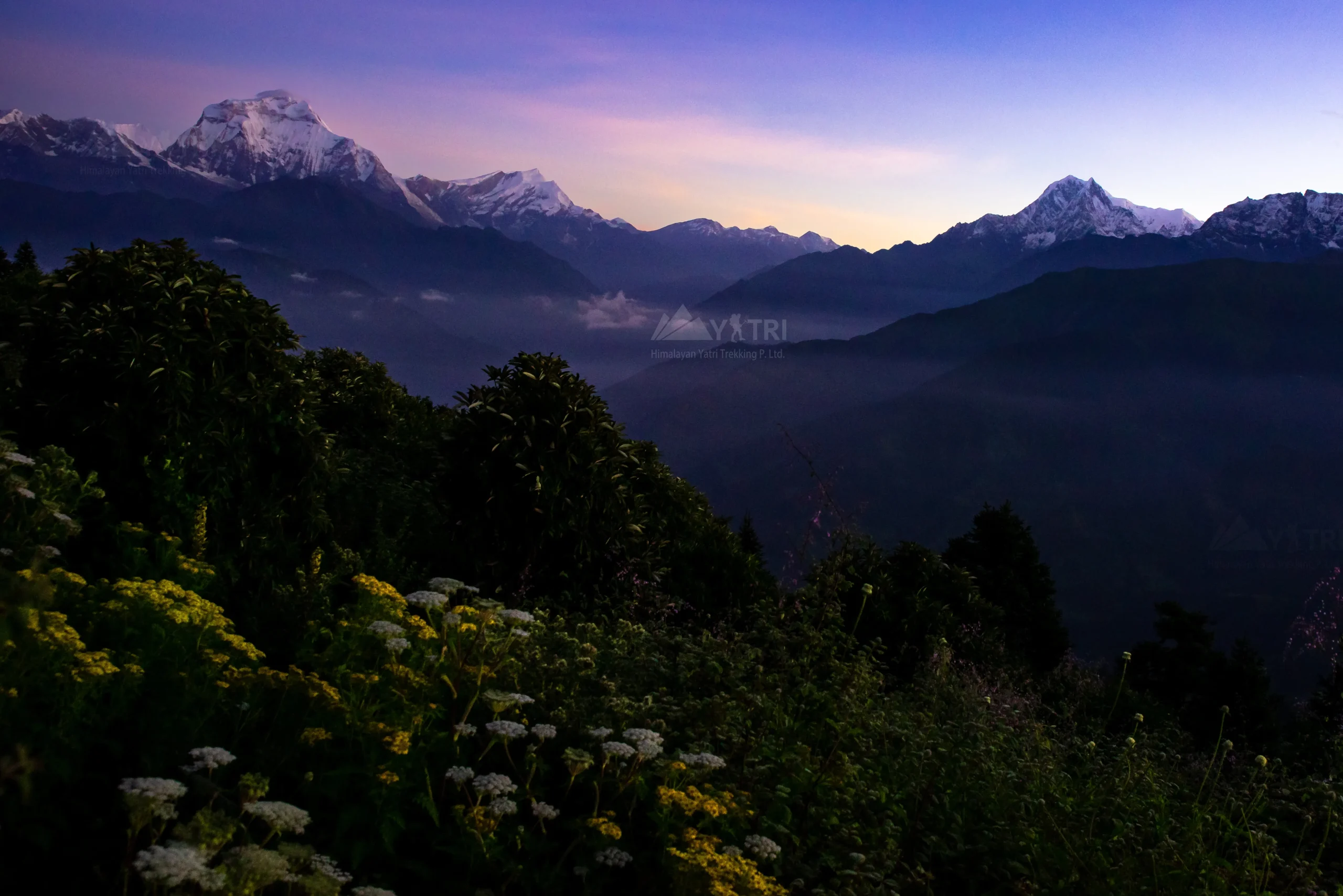
Mixed terraced fields and oak–rhododendron forest; arrival at Nagi, hub of community projects (school, health post, tech initiatives). Sunset views toward Dhaulagiri & Annapurna South.

Trip Facts
Max. Altitutde 2,320m
Trip Facts
Meal Plan Breakfast, Lunch, Dinner, Hot drinks
Trip Facts
Accomodation Community lodge
Trip Facts
Activity 5–6 hrs trek, steady ascent
Day 04

Trek Nagi → Mohare Danda – 3,320m

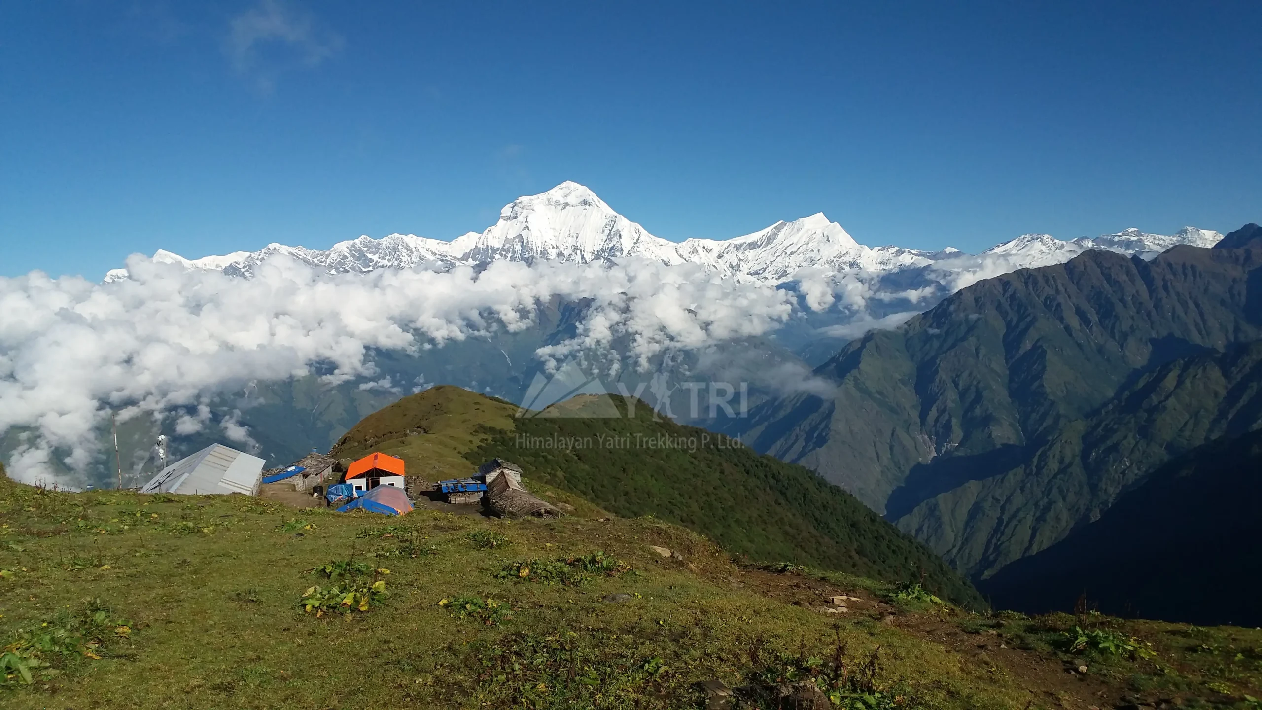
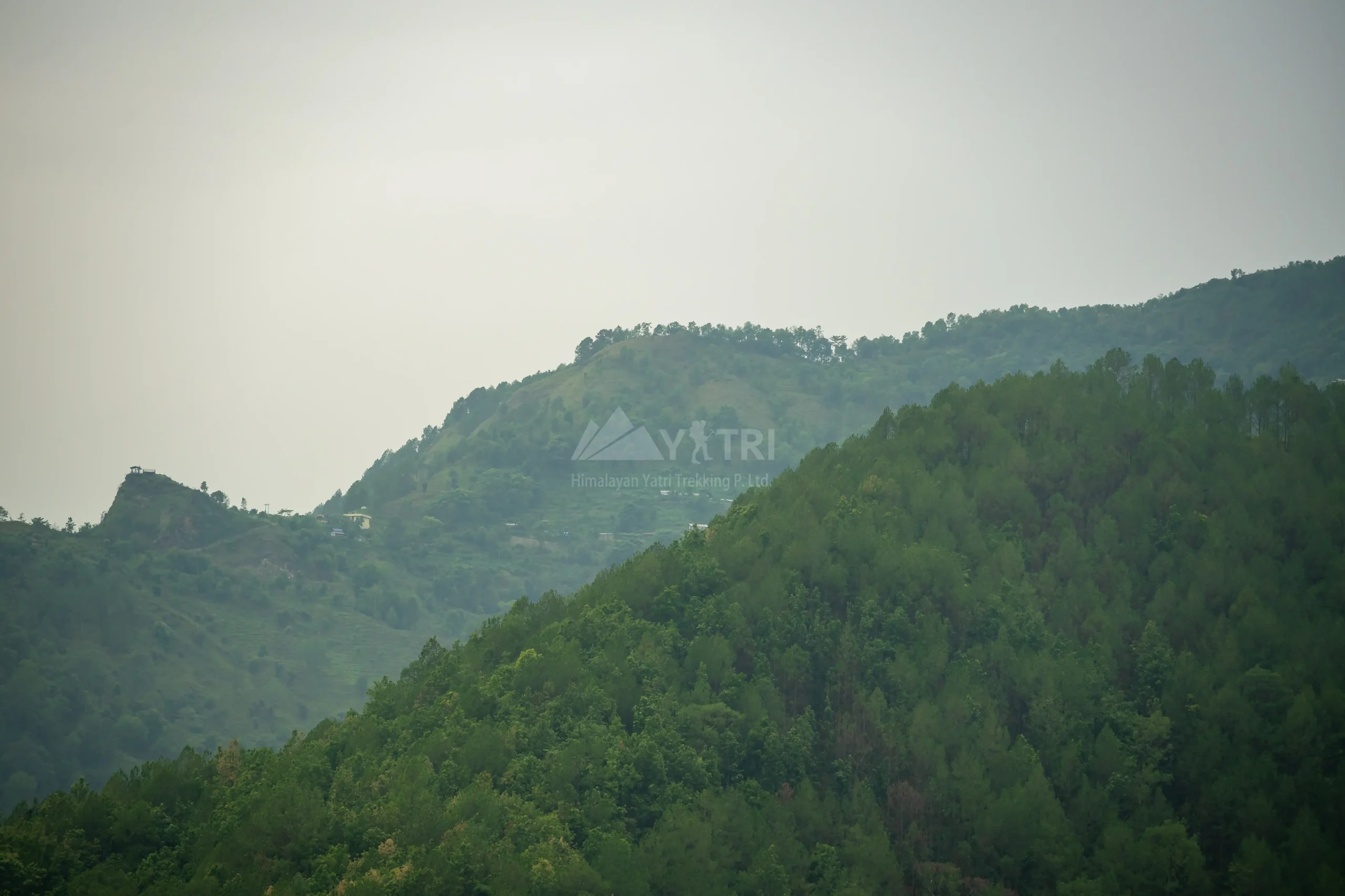
Ridge climb through rhododendron forests to Mohare Danda, a panoramic viewpoint above the Myagdi valley; sweeping sunrise/sunset over Dhaulagiri, Nilgiri, Annapurna South, Hiunchuli.

Trip Facts
Max. Altitutde 3,320m
Trip Facts
Meal Plan Breakfast, Lunch, Dinner, Hot drinks
Trip Facts
Accomodation Community lodge (eco-lodge)
Trip Facts
Activity 6–7 hrs trek, continuous ascent
Day 05

Trek Mohare Danda → Tikot Village – 2,250m

Descend along a scenic ridge to the traditional Tikot settlement; stone houses, millet fields, and Magar culture.

Trip Facts
Max. Altitutde 2,250m
Trip Facts
Meal Plan Breakfast, Lunch, Dinner, Hot drinks
Trip Facts
Accomodation Community homestay/lodge
Trip Facts
Activity 5–6 hrs trek, mostly downhill
Day 06

Trek Tikot → Khibang – 2,060m

Gentle forest and terrace paths linking village hamlets; warm community hospitality and local dishes (dhido, gundruk).

Trip Facts
Max. Altitutde 2,060m
Trip Facts
Meal Plan Breakfast, Lunch, Dinner, Hot drinks
Trip Facts
Accomodation Community homestay/lodge
Trip Facts
Activity 4–5 hrs trek, rolling terrain
Day 07

Trek Khibang → Swanta – 2,270m (via Sikha 2,040m)

Undulating trail via Sikha for lunch; continue to Swanta, gateway to Khopra. Chance to visit local monastery/school supported by trek revenues.

Trip Facts
Max. Altitutde 2,270m
Trip Facts
Meal Plan Breakfast, Lunch, Dinner, Hot drinks
Trip Facts
Accomodation Lodge/Community lodge
Trip Facts
Activity 5–6 hrs trek, moderate ascents/descents
Day 08

Trek Swanta → Khopra Ridge (Khopra Danda) – 3,660m

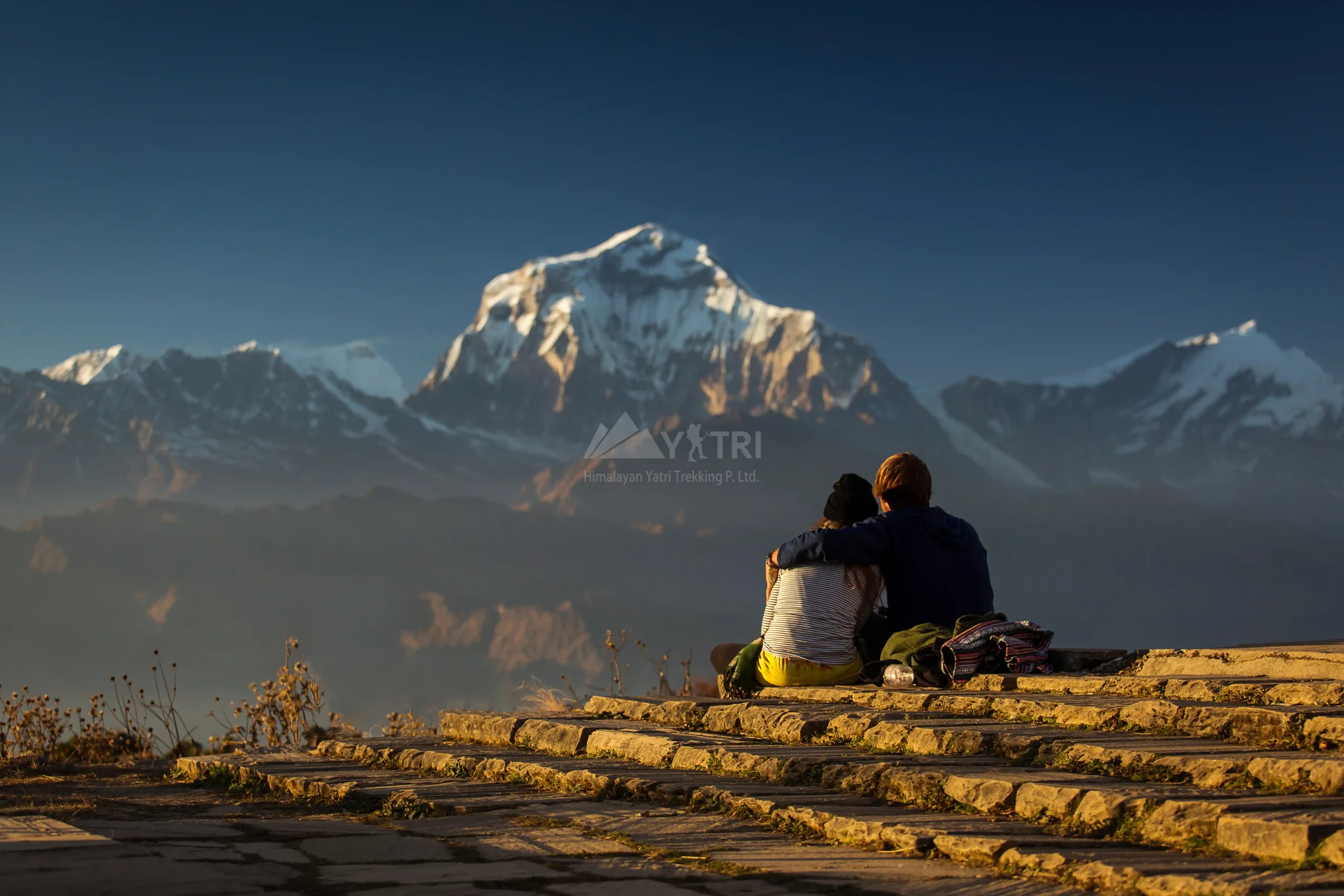
Steady ascent through rhododendron forest onto an airy ridge; dramatic close-up of Annapurna South and the Dhaulagiri wall. Sunset from Khopra is a trip highlight.

Trip Facts
Max. Altitutde 3,660m
Trip Facts
Meal Plan Breakfast, Lunch, Dinner, Hot drinks
Trip Facts
Accomodation Community lodge (Khopra)**
Trip Facts
Activity 4–6 hrs trek, sustained uphill
Day 09

Trek Khopra Ridge → Paudwar(e) – 2,000m

Long descent on shepherd trails to Paudwar, a large Magar village with terraced amphitheatres and Himalayan outlooks.

Trip Facts
Max. Altitutde 2,000m
Trip Facts
Meal Plan Breakfast, Lunch, Dinner, Hot drinks
Trip Facts
Accomodation Community homestay/lodge
Trip Facts
Activity 4–5 hrs trek, mostly downhill
Day 10

Trek Paudwar → Ghar Khola – 1,170m, drive to Pokhara – 822m

Final descent to the roadhead at Ghar Khola beside the Kali Gandaki; drive back to Pokhara for a lakeside evening.

Trip Facts
Max. Altitutde 822m
Trip Facts
Meal Plan Breakfast, Lunch
Trip Facts
Accomodation Hotel in Pokhara
Trip Facts
Activity 3–4 hrs trek + 5–6 hrs drive
Day 11

Drive Pokhara → Kathmandu – 1,400m

Scenic highway return via river valleys and mid-hills.

Trip Facts
Max. Altitutde 1,400m
Trip Facts
Meal Plan Breakfast, Lunch
Trip Facts
Accomodation (Hotel in Kathmandu on request)
Trip Facts
Activity 6–7 hrs drive

Additional Infromation

Cost Included

  • Airport Transfers: Private car service for airport pick‑up and drop‑off.
  • Ground Transportation: Travel comfortably by deluxe tourist bus and enjoy the convenience of a reserved private jeep.
  • Meals: Three freshly prepared meals each day, with seasonal fruits, tea, and coffee.
  • Accommodation: Best available teahouse lodges on a shared basis during the trek.
  • Guides & Porters: Licensed, English‑speaking trekking guide and dedicated porters to support your journey.
  • Crew Insurance: Comprehensive insurance coverage for our support team, including meals and daily wages.
  • Permits & Entry Fees: All necessary trekking permits, entry cards and monuments fees arranged by us.
  • Trekking Gear: Company‑provided duffel bags and trekking poles (to be returned after the trip).
  • Taxes & Service Charges: All official government taxes and agency service fees included.

Cost Excluded

  • International Travel: Flights to/from Nepal, visa fees, and airport taxes.
  • Personal Gear: Your own trekking equipment (except company duffel bags and trekking poles).
  • Beverages: Alcoholic and bottled drinks (tea and coffee are included).
  • Personal Insurance: Travel, accident, and medical emergency evacuation insurance.
  • Custom Duties: Nepal customs duty for goods imported by air or road.
  • Personal Expenses: Laundry, internet, and other items of personal nature.
  • Tips/Gratuities: Tips for guides and porters (not mandatory, but warmly appreciated).

TREKKING EQUIPMENT GUIDE FOR TREKKING IN THE HIMALAYAS

1) Head Wear

  • Fleece & woollen hat: Essential for cold mornings/evenings; covers ears to prevent frostbite.
  • Sun hat & sunglasses: Wide-brimmed hat for sun protection; sunglasses with UV400/glacier lenses for high altitude glare.
  • Lip balm & sunblock (SPF 30–50): Prevents cracked lips and sunburn; UV rays are stronger at altitude.
  • Scarf/Buff: Multipurpose: protects against dust, wind, and can be used as neck warmer.

2) Hands Wear

  • Wind fleece gloves: Lightweight warmth for mild conditions.
  • Waterproof insulated gloves: For snow or rain; keeps hands dry and warm.
  • Trail map & guidebook: Help you connect with the trail beyond just following and cultural insights.
  • Camera & reading books: Capture memories and relax during rest days/free time.
  • Trekking poles/walking sticks: Reduce knee strain, improve balance on steep terrain/descents.
  • Playing cards (optional): Great bonding within a group, fun and laughter.

3) Body Wear

  • Loose trekking T-shirts & pants: For daytime walking, Quick-dry, breathable fabrics.
  • Long-sleeve fleece T-shirt: Protects from sun and provides warmth.
  • Trousers & waterproof jackets/pants: Essential when clouds roll in, rain and wind protection.
  • Warm jacket (Down jacket): Lightweight but highly insulating; cozy armour above 3,500m.
  • Raincoat/rain cover: For sudden showers, especially in monsoon season.
  • Undergarments: Quick-dry, comfortable; pack enough for hygiene.

4) Foot Wear

  • Warm woollen socks: Several pairs; keep feet dry and warm.
  • Trekking boots: Durable, waterproof, and designed for comfort with strong ankle support.
  • Camp shoes/sandals: Comfortable for evenings in lodges or camp.
  • Crampons & gaiters: For icy trails or deep snow; gaiters prevent snow/mud entering boots.

5) Sleeping

  • Sleeping bag (-15°C rating): Necessary for high-altitude lodges where blankets may be insufficient.
  • Silk liner: Adds warmth and keeps sleeping bag clean.
  • Pillow/sleeping pad: Extra comfort, especially in basic/simple lodges or camping treks.

6) First-Aid Kit

  • Personal medicines: For fever, cold, headaches, stomach issues.
  • Moleskin/blister pads: Prevent painful blisters.
  • Diamox (consult your doctor): Helps prevent altitude sickness.
  • Other medicines: As per personal health needs (consult physician before trek).

7) Toiletries & Personal Hygiene

  • Light towel & face cloth: Quick-dry preferred.
  • Toothbrush, paste & shavers (razor): Basic hygiene.
  • Shampoo & conditioner: Small travel bottles.
  • Face & body moisturizer: Prevents dry skin at altitude.
  • Comb & nail clipper: Personal grooming.
  • Toilet paper: Not available in lodges or camp.
  • Hand sanitizer: Essential for hygiene.
  • Eco-friendly soap: to protect the environment.
  • Feminine hygiene products: Pack sufficient supplies for the whole trek.

8) Backpack

  • Day backpack (40–45L): For essentials jacket, snacks, water, camera, money belt.
  • Rain cover: Protects gear during showers.

9) Kit Bag

  • Duffel bag (max 12kg): Preferred by porters; lockable and waterproof.

10) Important Documents

  • Extra passport photos: Needed for permits.
  • Photocopies of passport: As backup.
  • Travel insurance papers: Make sure for your trekking/altitude is covered; carry policy number.

11) Others

  • Camera with extra batteries/charger & memory card: Cold drains batteries quickly.
  • Headlamp/torch with spare batteries: For early starts, nights or power cuts.
  • Money belt/purse: Keep cash, documents safe.
  • Energy/protein bars: Quick energy boost on trail.
  • Water bottles (2 liters total): Essential for staying hydrated throughout the trek.
  • Water purification tablets/filter: Safe drinking water in remote areas.

What to Expect During the Khopra Ridge Community Trek

The Khopra Ridge Community Trek offers a unique and peaceful Himalayan experience that combines breathtaking mountain scenery with authentic cultural encounters. As you walk along this off-the-beaten-path trail, you can expect stunning panoramic views of iconic peaks such as Dhaulagiri, Annapurna South, Nilgiri, and Machhapuchhre, especially during sunrise and sunset from Khopra Ridge.

The journey takes you through a variety of landscapes, including lush rhododendron forests, terraced farmland, alpine meadows, and quiet high ridges, making each day visually refreshing and diverse. Unlike more crowded trekking routes in the Annapurna region, this trek provides a calm and less touristy atmosphere, allowing you to truly connect with nature.

Accommodation along the trail is in community-run lodges, where you can enjoy simple but hearty meals like dal bhat while directly supporting local villages. Daily trekking involves moderate walking of around 4 to 7 hours, with a mix of gradual ascents and some steep sections. An optional highlight of the trek is the challenging hike to Khayer Lake, a sacred alpine lake that sits at a higher altitude and rewards trekkers with spectacular scenery and spiritual significance.

Best Time to Do the Khopra Ridge Community Trek

The best time to do the Khopra Ridge Community Trek is during the spring and autumn seasons, as these months offer the most favorable weather and visibility.

Spring, from March to May, is particularly beautiful because the rhododendron forests bloom in vibrant colors, creating a picturesque trekking environment with mild temperatures.

Autumn, from September to November, is considered the ideal season overall due to its clear skies, stable weather conditions, and excellent mountain views, making it perfect for photography and high-altitude trekking.

Winter, from December to February, is also an option for those who prefer solitude, as the trails are quieter and the landscapes are often covered in snow, however, temperatures can drop significantly, especially at higher elevations.

The monsoon season, from June to August, is generally not recommended because heavy rainfall can make trails slippery, obscure mountain views, and bring leeches in lower regions, which can affect the overall trekking experience.

Khopra Ridge Community Trek Difficulty

The Khopra Ridge Community Trek is considered moderately difficult, making it suitable for beginners with a reasonable level of fitness as well as experienced trekkers looking for a quieter alternative to more popular routes.

The trek typically involves walking for 4 to 7 hours per day on a mix of forest trails, stone steps, and ridge paths, with some sections requiring steady uphill climbs. One of the main challenges is the altitude, as Khopra Ridge sits at around 3,660 meters and the optional hike to Khayer Lake reaches approximately 4,660 meters, where trekkers may experience mild altitude-related symptoms if not properly acclimatized.

Weather conditions can also add to the difficulty, with cold mornings and nights, especially at higher elevations. While the trek does not require technical climbing skills, the combination of altitude, terrain, and long walking days makes it physically demanding at times. However, with proper preparation, pacing, and acclimatization, most trekkers can complete the journey comfortably and enjoy the rewarding views and peaceful environment it offers.

Trip Faqs

Why is it called a community trek?

It is called a community trek because the lodges and services are managed by local communities. The revenue directly contributes to local development, education, and conservation efforts.

Is altitude sickness a concern on this trek?

The trek reaches an altitude of around 3,660 meters (Khopra Ridge) and higher if you visit Khayer Lake. While the risk is moderate, proper acclimatization and hydration help prevent altitude sickness.

What kind of accommodation is available?

ccommodation is mainly in community lodges and teahouses. These are simple but comfortable, offering basic amenities and warm hospitality.

Do I need a guide for the Khopra Ridge Trek?

While it is possible to trek independently, hiring a guide is highly recommended for navigation, safety, and a richer cultural experience. It also helps support the local economy.

How long does the Khopra Ridge Community Trek take?

The trek typically takes 7 to 10 days, depending on the itinerary and pace. Some trekkers also include a visit to Khayer Lake, which may add an extra day.

What is the best time to do the Khopra Ridge Community Trek?

The best seasons are spring (March–May) and autumn (September–November). During these months, the weather is stable, skies are clear, and mountain views are at their best.

How difficult is the Khopra Ridge Community Trek?

This trek is considered moderate in difficulty. It involves daily walking of 5–7 hours with gradual ascents. While no technical climbing is required, a basic level of fitness is recommended.

What is the Khopra Ridge Community Trek?

The Khopra Ridge Community Trek is a lesser-known trekking route in the Annapurna region of Nepal. It is a community-managed trail that offers stunning views of the Himalayas while directly supporting local villages and sustainable tourism initiatives.

Ready to Start Your Journey?

Customize your own travel plans based on your needs and preferences.

Plan your trip
chat-in-website
Need Help? Chat with us
chat-in-website
Need Help? Chat with us